UAV & Drone Lidar Mapping

UAV & Drone Lidar Mapping

Explore precision geospatial data with PT Explora Prima’s leading UAV & Drone Lidar Mapping services.

WHY CHOOSE UAV IN EXPLORA PRIMA ?

  • On Demand – Flexible deployment
  • Less investment compared with full size aircraft
  • Fly below cloud, clearer image resolution
  • Less operating cost compared to traditional method
REVOLUTIONARY MAPPING

A fully automated aerial scan collects raw digital images from between 100 to 1000 meters altitude. These GPS positioned images have very high overlap

WHO NEEDS MICRODRONES ?

  • Mining Industry
  • Highway Construction
  • Forestry & Plantation
  • High Volatage Powerline Monitoring
  • Archeological And Cultural Heritage
  • Simulation before Election
  • Environmental Changes ( Time Series )
  • Oil and Gas

WHY CHOOSE MICRODRONES ?

  • Fast ( Flight Time up to 20 minutes & Flight Speed 2-5 m/s)
  • Safety ( Laser safety class : 1)
  • Efficient ( Coverage 20 + Ha/flight )
  • Effective ( Minimun Personnel )
  • ALess Const ( No GCP need )
  • Accurate ( Vertikal Absolute accuranvy : +/-6 cm , Horizontal ansolute accurancy : +/-6 cm)

WE CAN OFFER YOUT THE FOLLOWING SERVICES :

  • Rapid Deployment

    With A wingspan of just 1m and weight of only 2kg, this lightweight aircraft is able to mobilise to any location on a commercial airline carrier

  • Fast turn around time

    Project are planned, flown and processed in as little as a 24hr period. This is possible due to the automated processing solution

  • One Square kilometre blocks

    The UAV utilises a lithium ion battrey to power the plane, navigation system and camera

  • Photogrammetric Mapping

    We use photogrammetric software for post processing and map production

  • Orthophotos

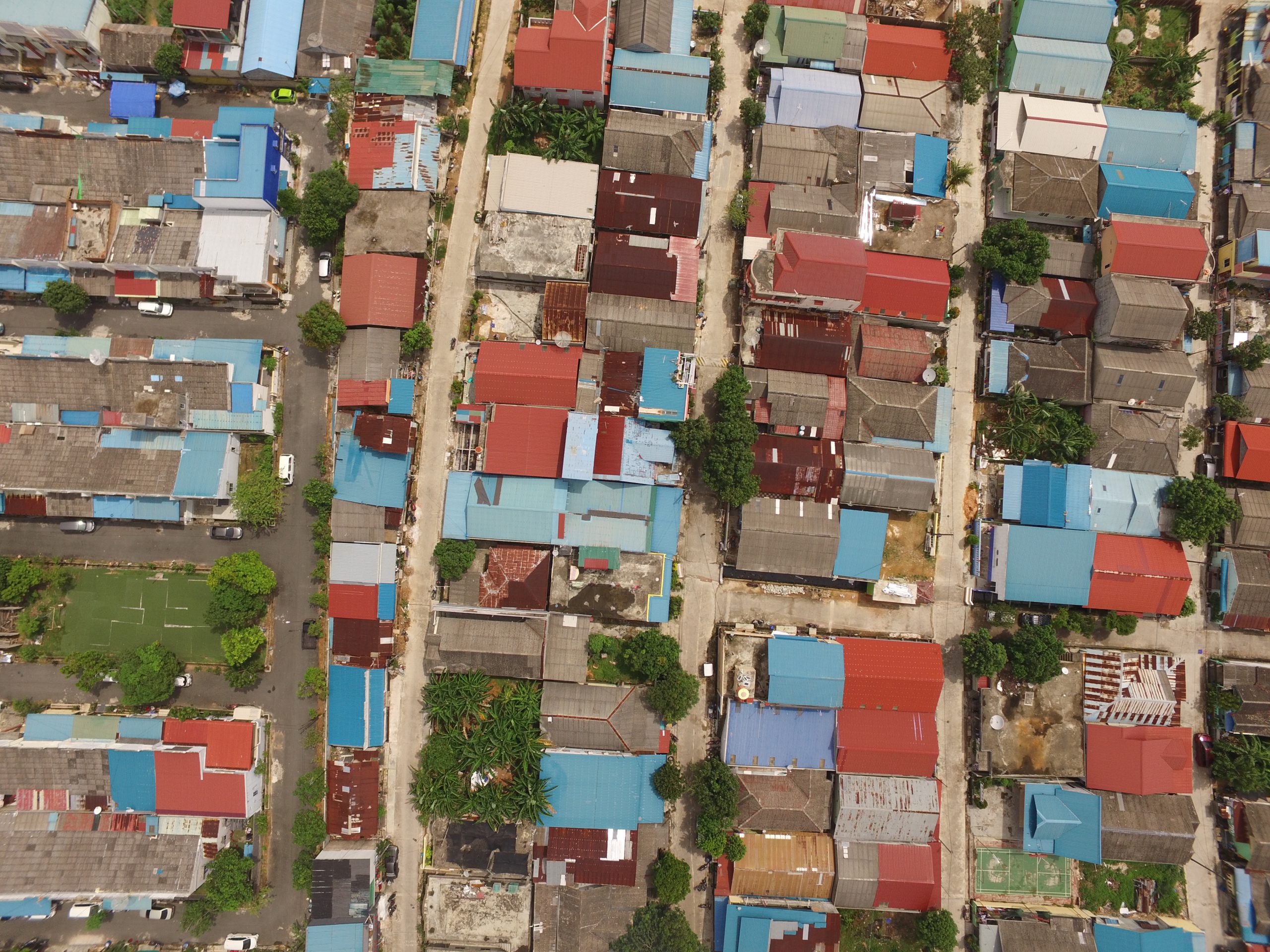
    Raw images from the UAV are digitally processed into high quality orthophotos

  • Digital Elevation Model

    Processing of the UAV data also yeilds a Digital Elevation Model (DEM). The DEM is a digital representation of ground surface topography including all objects, trees and structures