
PT Explora Prima | Survey Specialist

3D Laser Scan Survey Of The Eastern Constellation Cargo Vessel

Project detail

With our years of experience and expertise in 3D laser scan services for surveying, we can deliver high-quality results that can never be disputed

In the maritime industry, accurately measuring the dimensions of large ships can be a complex and time-consuming task. To make this process easier and more efficient, 3D laser scanning technology has been developed to quickly and accurately measure ship outline dimensions.
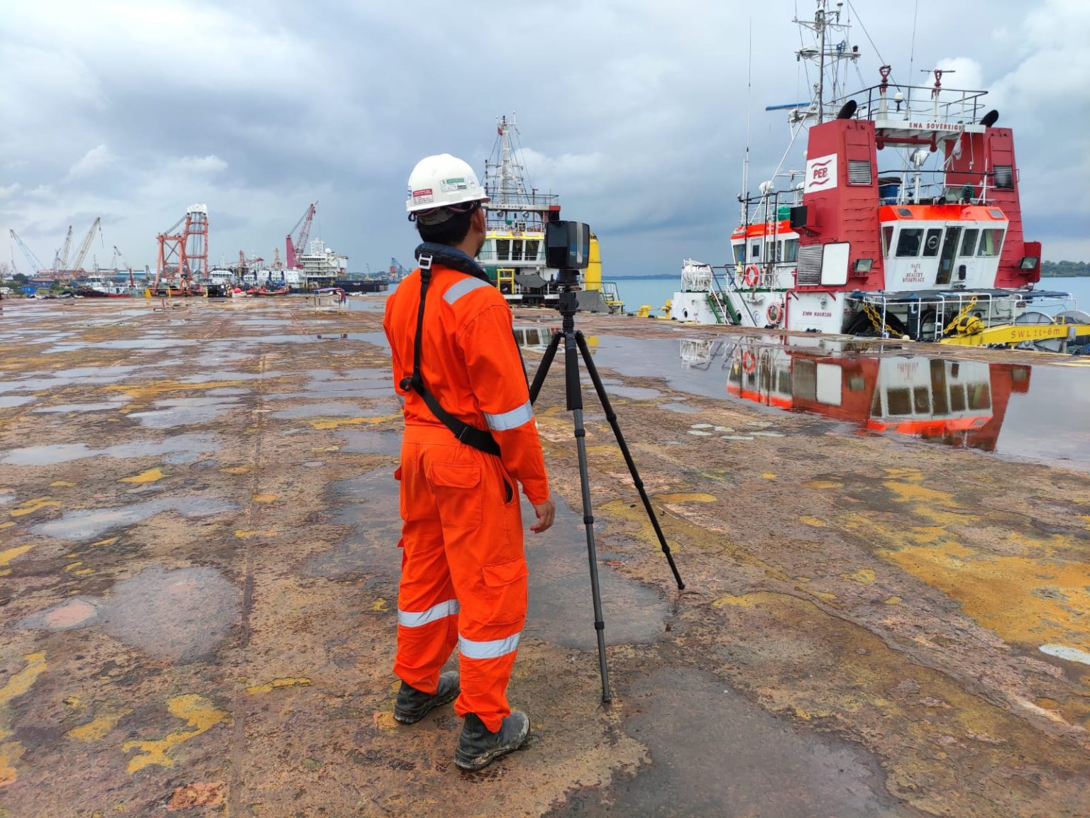
The Eastern Constellation Cargo Vessel required Explora Prima to conduct a survey to determine in detail the dimensions of its main deck outline. Due to Explora Prima’s ability and experience, the resulting 3D point cloud data can never be disputed when compared to traditional survey methods because of its accuracy.

Traditional surveying is a reliable method that has been used for many years, but it can be time-consuming and requires skilled surveyors. 3D laser scanning is a relatively new technology that can capture a large amount of data quickly and accurately, making it more efficient for many applications.
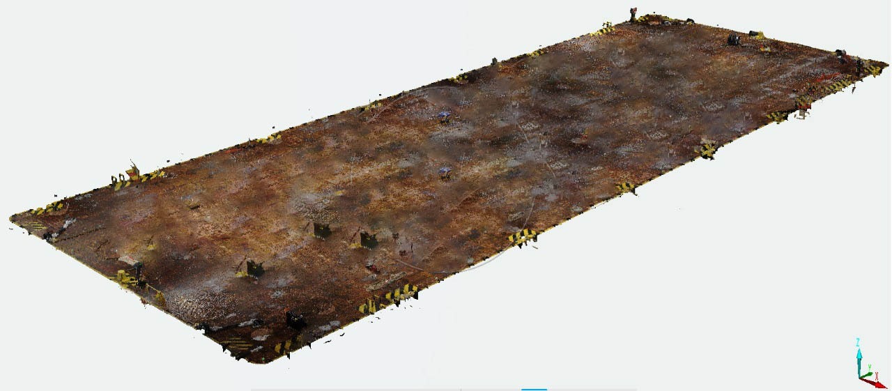
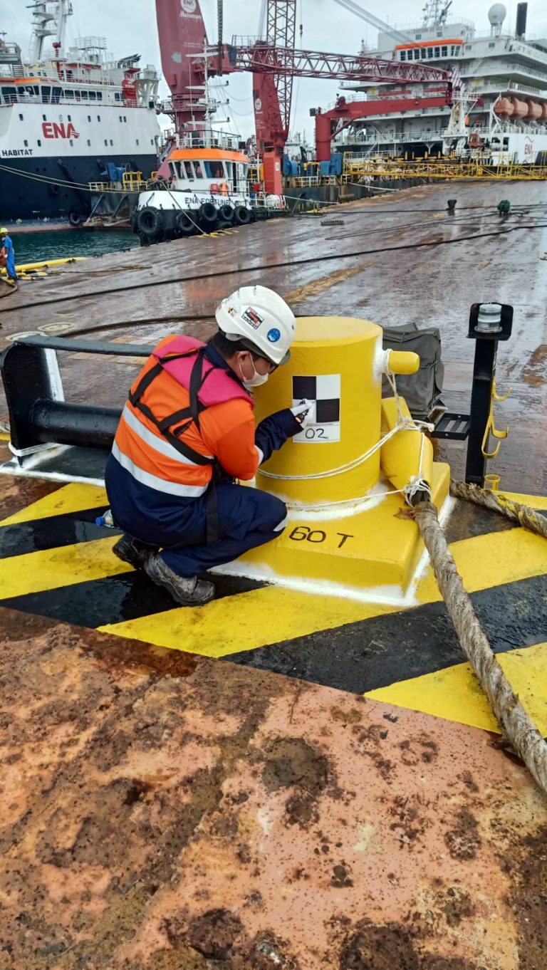
Work carried out last January, Explora Prima assigned competent Surveyors, Data Processors and surveying equipment to carry out 3D Laser Scanning such as Faro Scanner and Total Station. And as part of our commitment to ZERO ACCIDENTS, we always equip workers with safety standard equipment and provide guidance regarding the importance of safety work operational standards.

Details:

Location:

Batam, Kepulauan Riau

Category:

3D Laser Scanning

Client:

PT Pandan Bahari Shipyard

Date:

20/01/2023

get started

Ready To Start Your Survey Project?

faqs

Frequently Asked Questions

We regularly partner with clients across multiple demanding sectors, providing specialized survey support for Oil & Gas, Maritime and Hydrographic operations, Shipyards, Mining sites, Civil Infrastructure, and Plantations.

To ensure high precision and reliable deliverables, we utilize industry-standard instruments such as High-Definition 3D Laser Scanners, Hydrographic Echosounders, and UAV LiDAR systems, combined with advanced data processing software like Leica Infinity.

Timelines vary depending on the site location, area scale, and specific scope of work. While routine land or hydrographic surveys can be completed in a matter of days, more complex or large-scale projects require a structured timeline that we outline prior to mobilization.

We provide comprehensive, client-ready digital deliverables customized to your engineering and operational needs—ranging from 2D CAD layouts and 3D point cloud models to bathymetric charts and detailed technical reports.

Yes, we are. Backed by certified survey personnel, robust field equipment, and our certified ISO 9001:2015 quality management systems, we are fully prepared to execute both large-scale onshore and offshore assignments.

Getting started is easy. You can fill out our website inquiry form, email us directly, or reach our office team by phone so we can discuss your project requirements and provide a proper consultation.